Software, Tools & Applied Projects
Open-source scientific software, hydrologic modeling tools, and applied geospatial projects spanning flood inundation mapping, benchmarking, hydrography integration, forecasting, WebGIS, field surveying, and decision-support workflows.
Tools, Packages & Data Products
Software products, open datasets, and research-grade tooling developed for operational flood forecasting, model evaluation, hydrography integration, and geospatial data access.
Modular open-source testbed for Flood Inundation Mapping (FIM), supporting configurable simulations, standardized APIs, custom datasets, documentation, and research-to-operations workflows.
Python framework for generating Flood Inundation Mapping across the United States using NOAA OWP HAND-FIM, with adoption by NOAA's National Water Center and strong research-to-operations impact.
Evaluation framework for flood-inundation predictions across extensive benchmark databases, enabling standardized quality assurance and large-scale comparative assessment across 200+ real and synthetic events.
 Actively Running
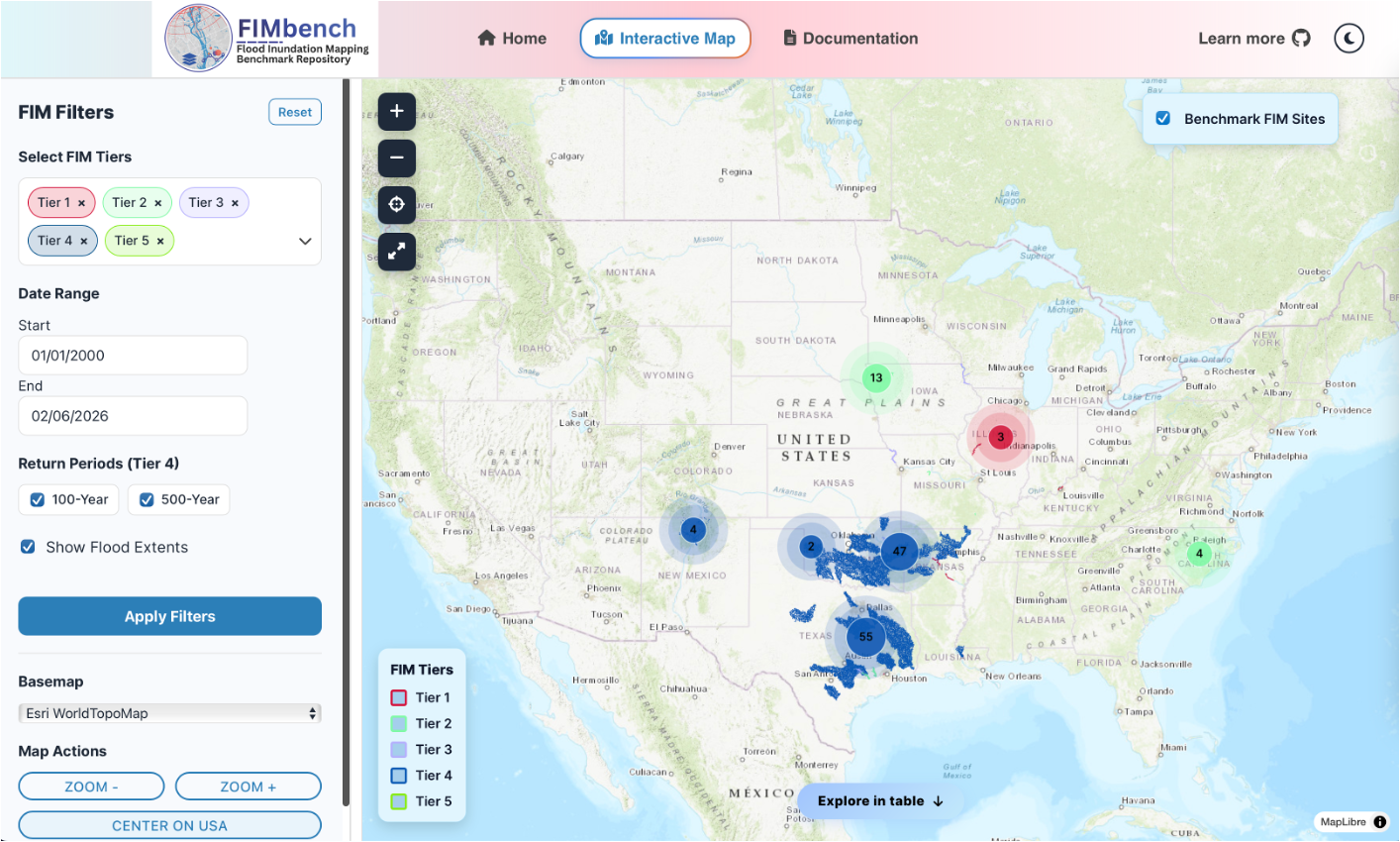
Benchmark database and companion tooling for organizing multi-tier flood-inundation products, reference data, and comparative evaluation workflows at scale.
 Actively Running
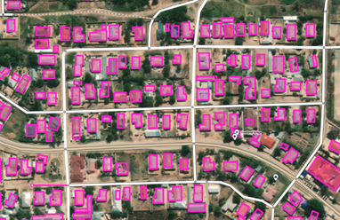
Extract MS footprints based on AOI. Python package for turning Microsoft's global building footprints into local, analysis-ready layers for exposure mapping, disaster assessment, and urban workflows.
 Actively Running
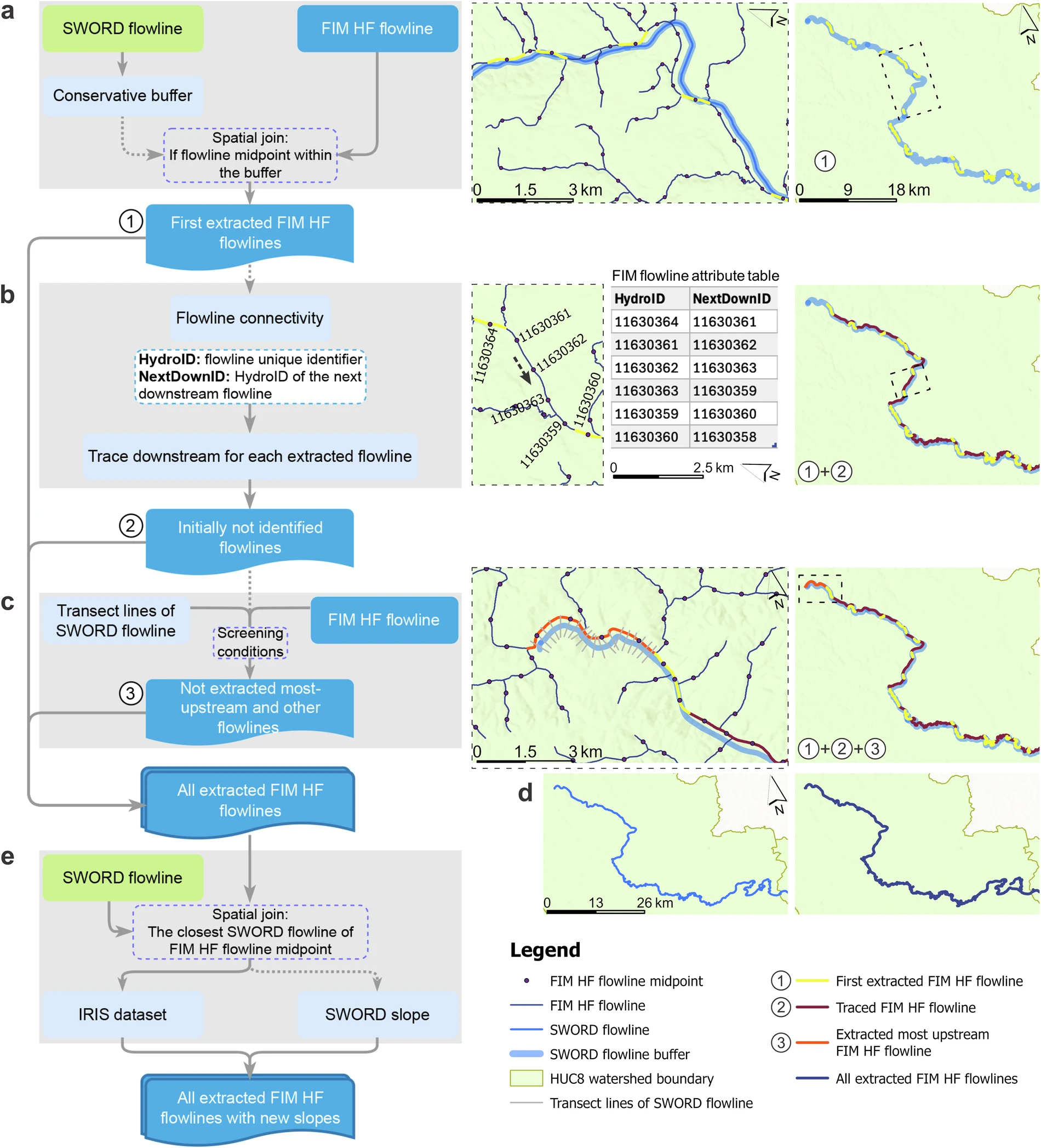
Hydrofabric flowlines join tool for spatially joining river flowlines across NHDPlus, MERIT Hydro, and related datasets for bidirectional attribute sharing and remote-sensing data integration.
GIS, WebGIS, Surveying & Decision Support
Selected applied work spanning flood modeling experiments, pluvial flooding representation, weather forecasting, spatial databases, WebGIS, and field-based mapping practice.
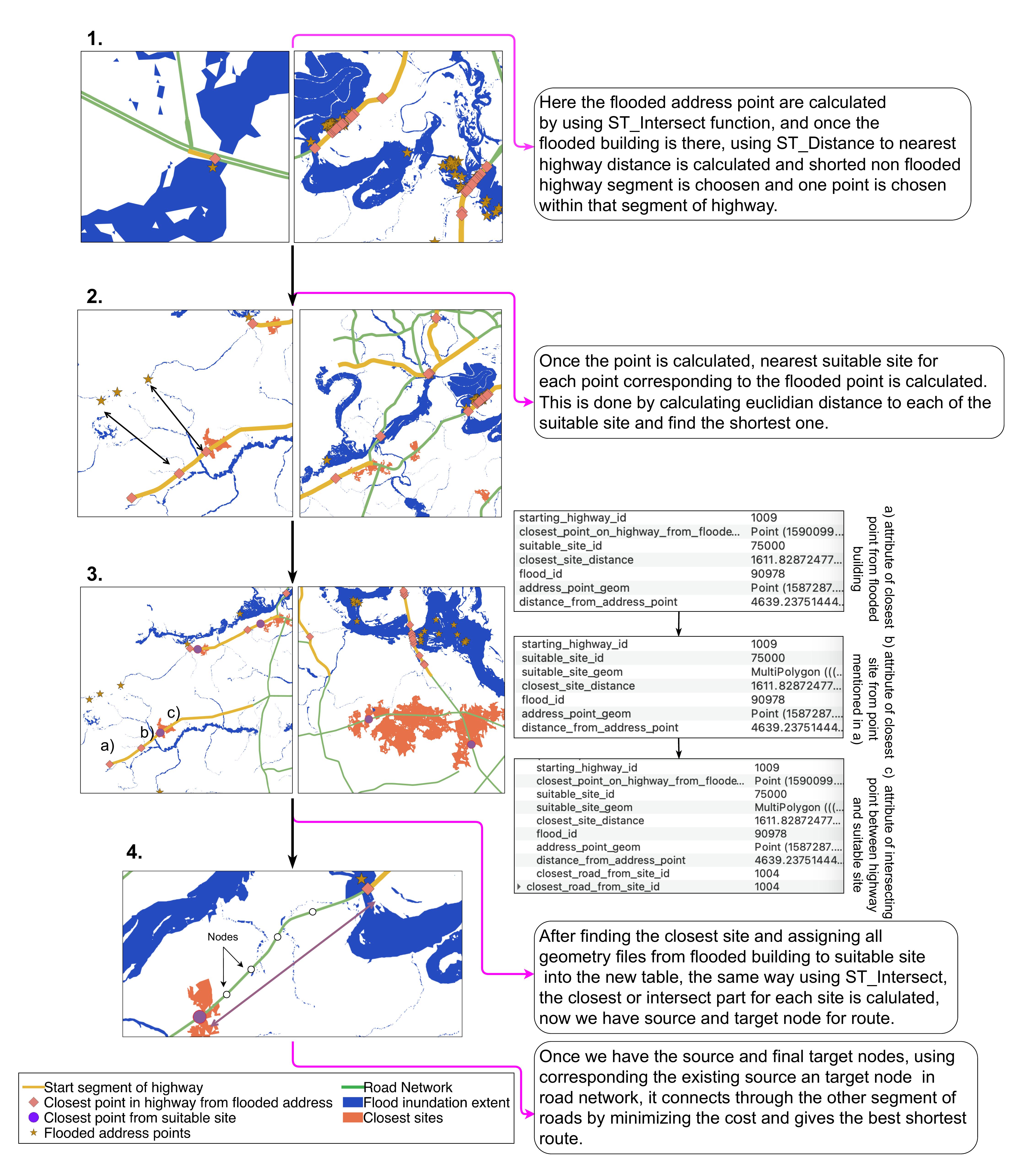
Emergency evacuation planning framework using PostgreSQL/PostGIS network analysis for real-time flood risk route optimization based on changing flood magnitude and demographics.
Since undergrad, I have worked across UAV survey and orthomosaic processing, LiDAR acquisition and terrain processing, GPS data collection, DGPS and field surveying, humanitarian open mapping, WebGIS visualization, weather prediction, and GDAL-based image analysis.
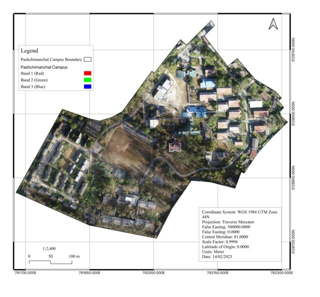
Drone survey workflows: image capture, photogrammetric processing, orthomosaic generation, and orthophoto QA for mapping and planning.
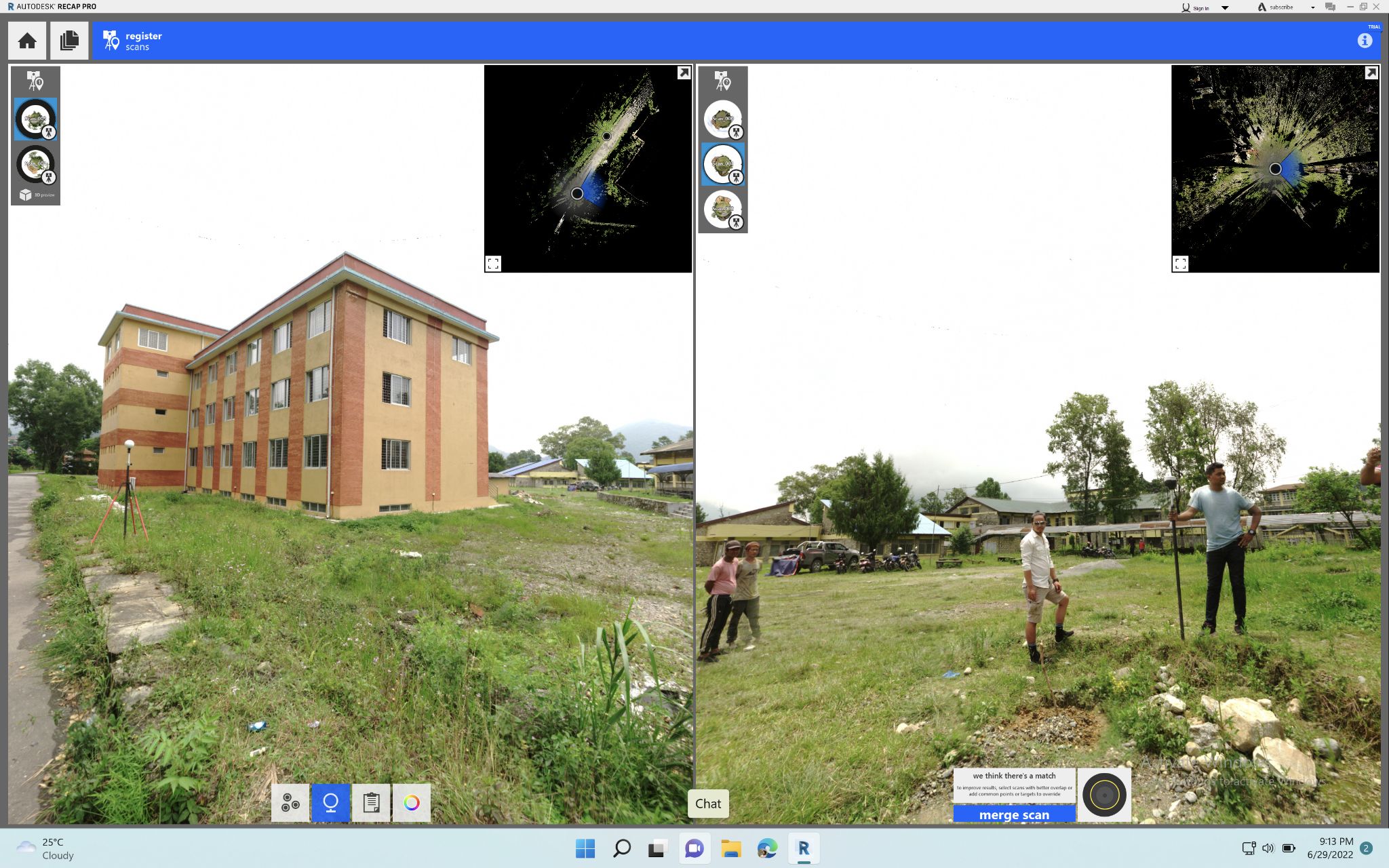
Acquisition-to-product LiDAR workflows: point cloud processing, DEM generation, slope/terrain analysis, and data QA for modeling.
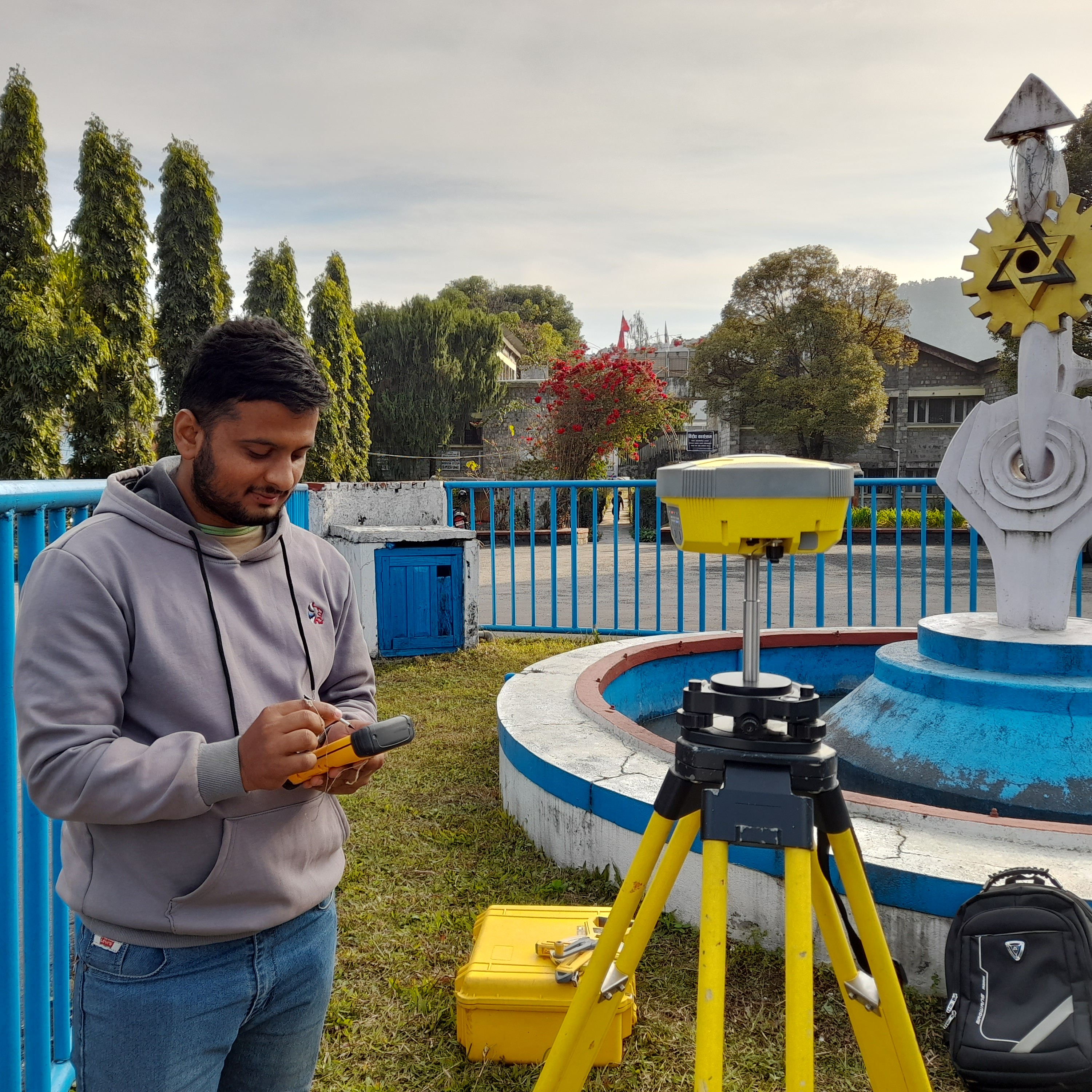
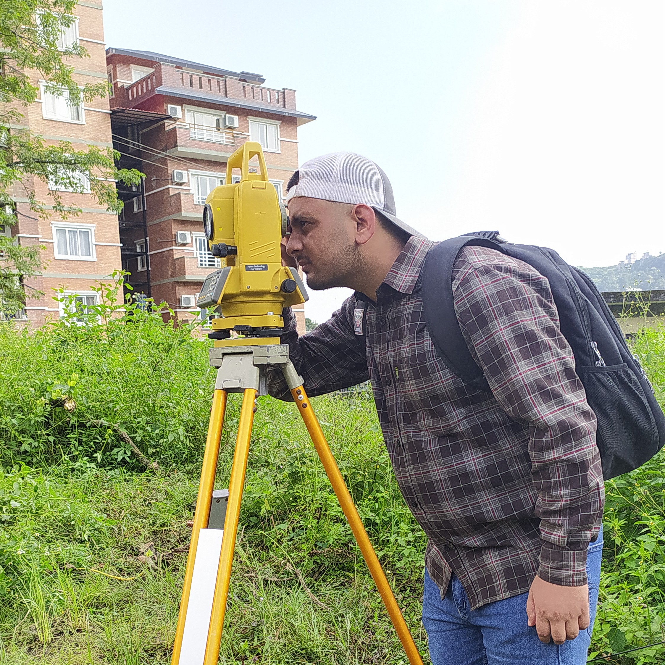
DGPS and field-control workflows for survey-grade geolocation, site verification, and coordinate control used in mapping and modeling projects.
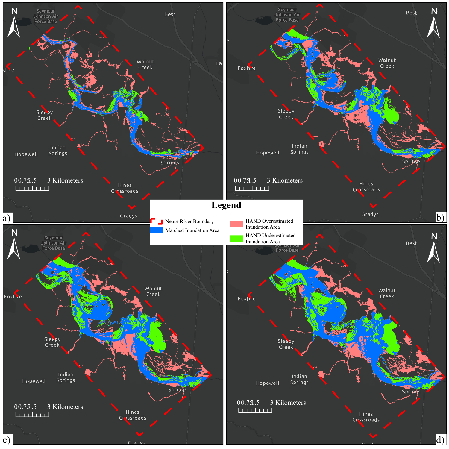
Detailed comparison of operational OWP HAND-FIM predictions against physics-based HEC-RAS simulations, helping frame surrogate-model post-processing and model-improvement workflows.
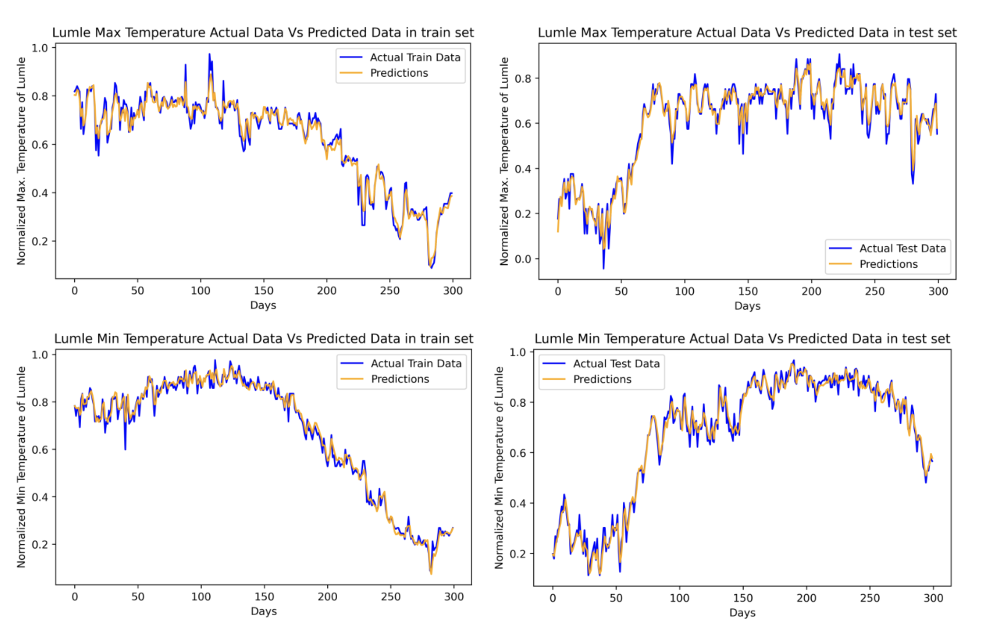
Undergraduate thesis project using Long Short-Term Memory models and meteorological station data to improve short-term weather forecasting across stations in Kaski District, Nepal.
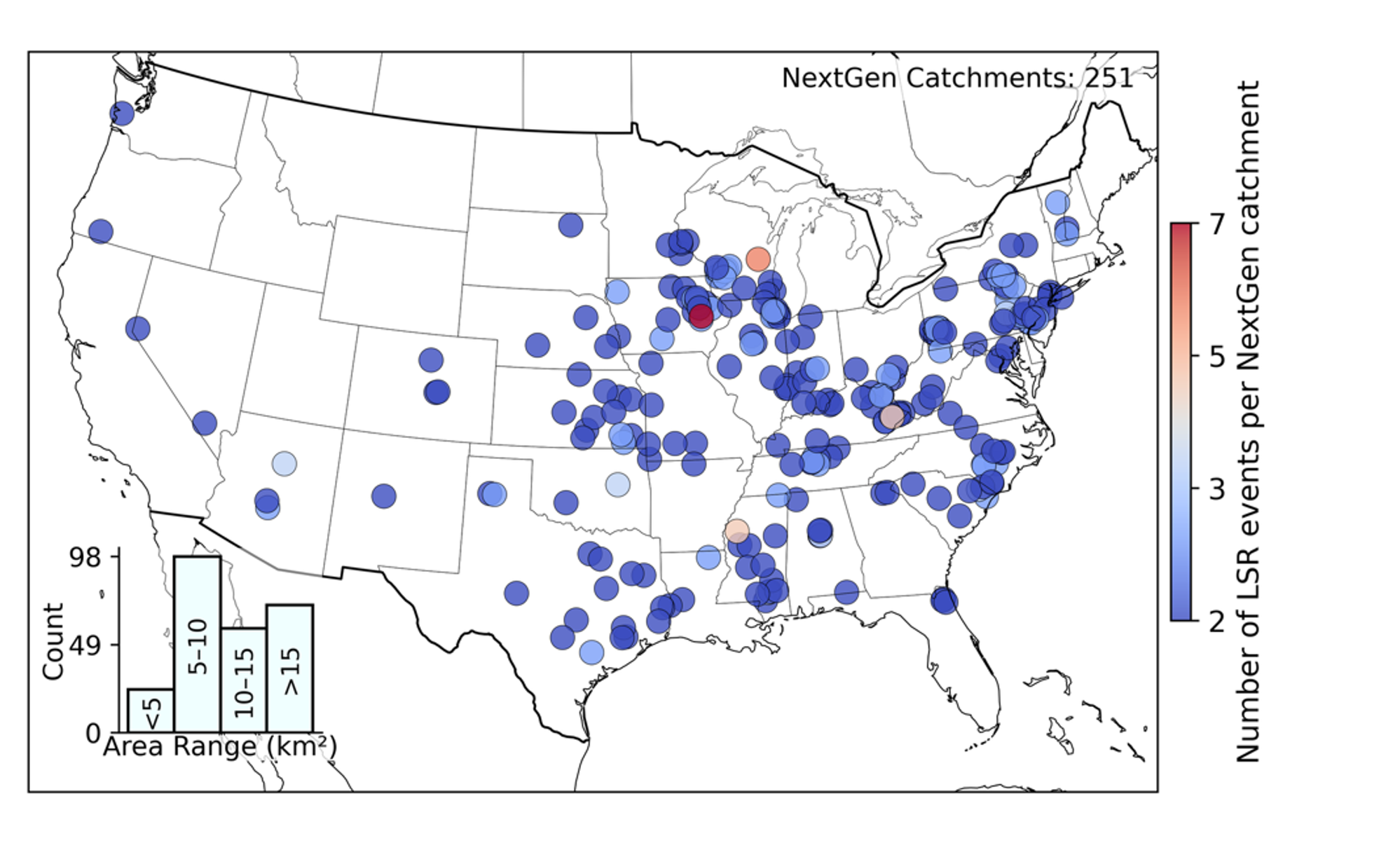
Summer institute project developing pluvial flood indices and validating them across 595 flood events in 251 catchments to support NOAA's next-generation water modeling framework.