Applied GIS
Field surveying, mapping training, and GNSS control collection.
Read moreField UAV surveys used for high-resolution mapping, orthomosaic generation, and photogrammetric analysis. Work includes flight planning, ground-control collection, image processing (Pix4D/Agisoft/OpenDroneMap workflows), orthorectification, and QA for use in planning and analysis.
Detailed report: https://doi.org/10.13140/RG.2.2.35430.29767/2
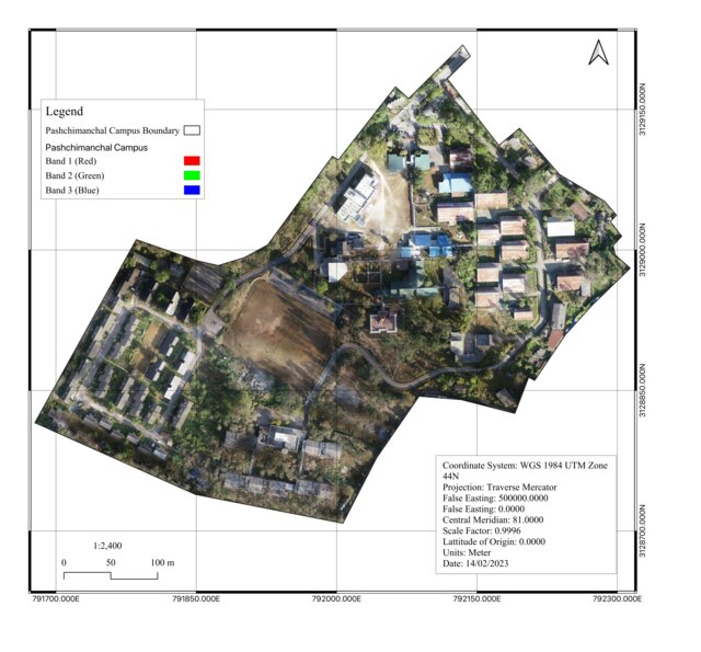
High-resolution UAV products enable site-scale mapping where satellite imagery is too coarse. They support planning, damage assessment, and model calibration with survey-grade spatial fidelity.