GitHub
Project repository.
Open GitHubThis project uses PostgreSQL/PostGIS and network analysis to support dynamic evacuation route planning under flood-risk scenarios. It combines spatial datasets, suitability analysis, and routing logic into a decision-support workflow.
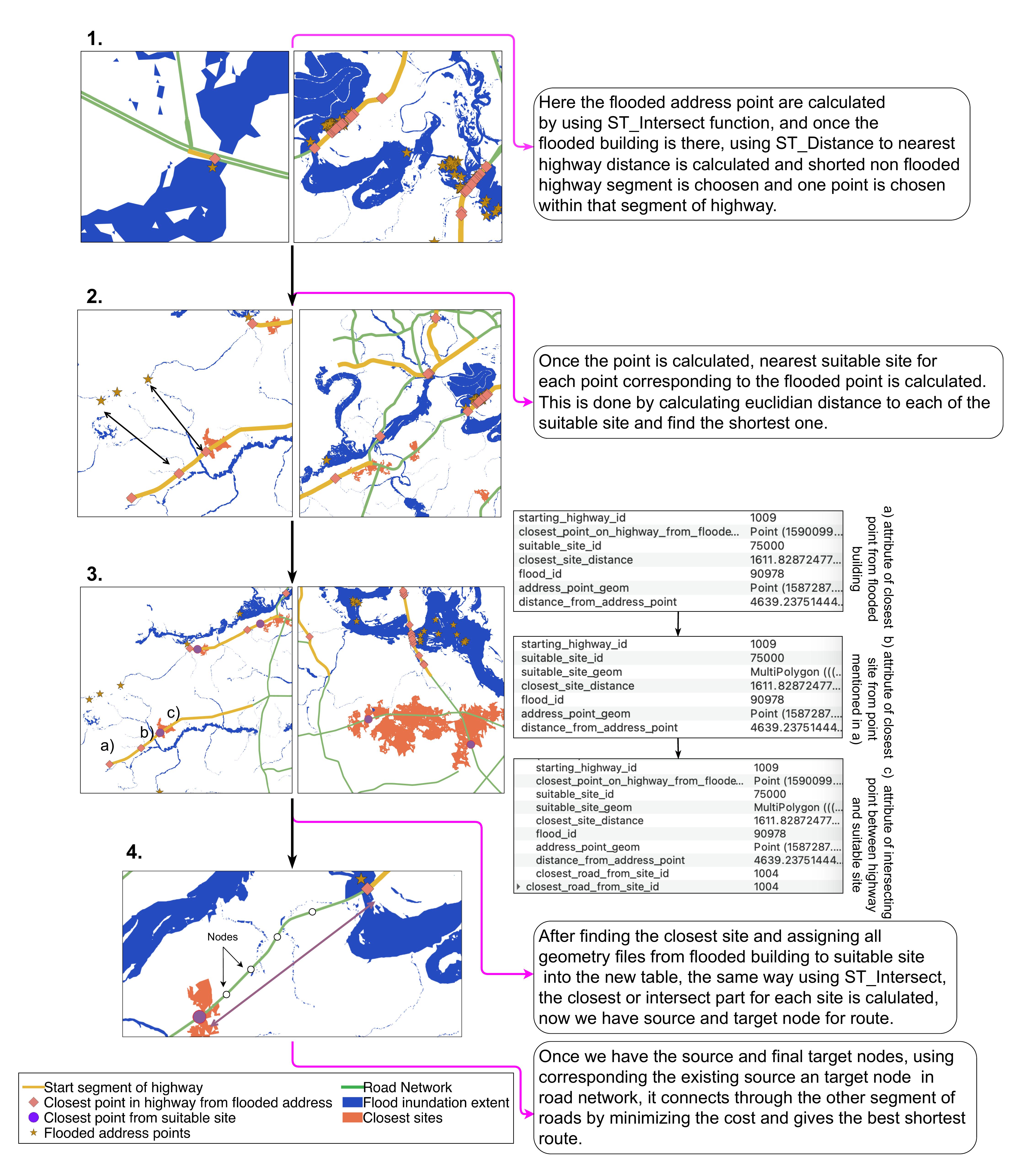
Emergency workflows need spatial systems that can update as conditions change. This project demonstrates the database and automation layer behind that type of decision support, integrating flood severity and population vulnerability into routing logic to produce evacuation guidance that reflects real-world constraints.