Back to projects
Hydrography ยท Spatial joins

RiverJoin โ€” Spatially Join Two Hydrofabric Bidirectionally

Project BriefUpdated May 9, 2026

Hydrofabric flowlines join tool for spatially joining river flowlines across hydrographic datasets. RiverJoin supports bidirectional translation of river attributes between products such as NHDPlus and MERIT Hydro.

PythonHydrographySpatial JoinVector Data
RiverJoin preview

What It Does

  • Bidirectionally joins NHDPlus and MERIT Hydro river flowlines for attribute transfer and translation.
  • Enables integration of ICESat-2 satellite altimetry-derived slope data into river network datasets.
  • Improves interoperability between river network products used across hydrologic modeling systems.
  • Methodology adopted by NOAA OWP for operational hydrofabric workflows.

Why It Matters

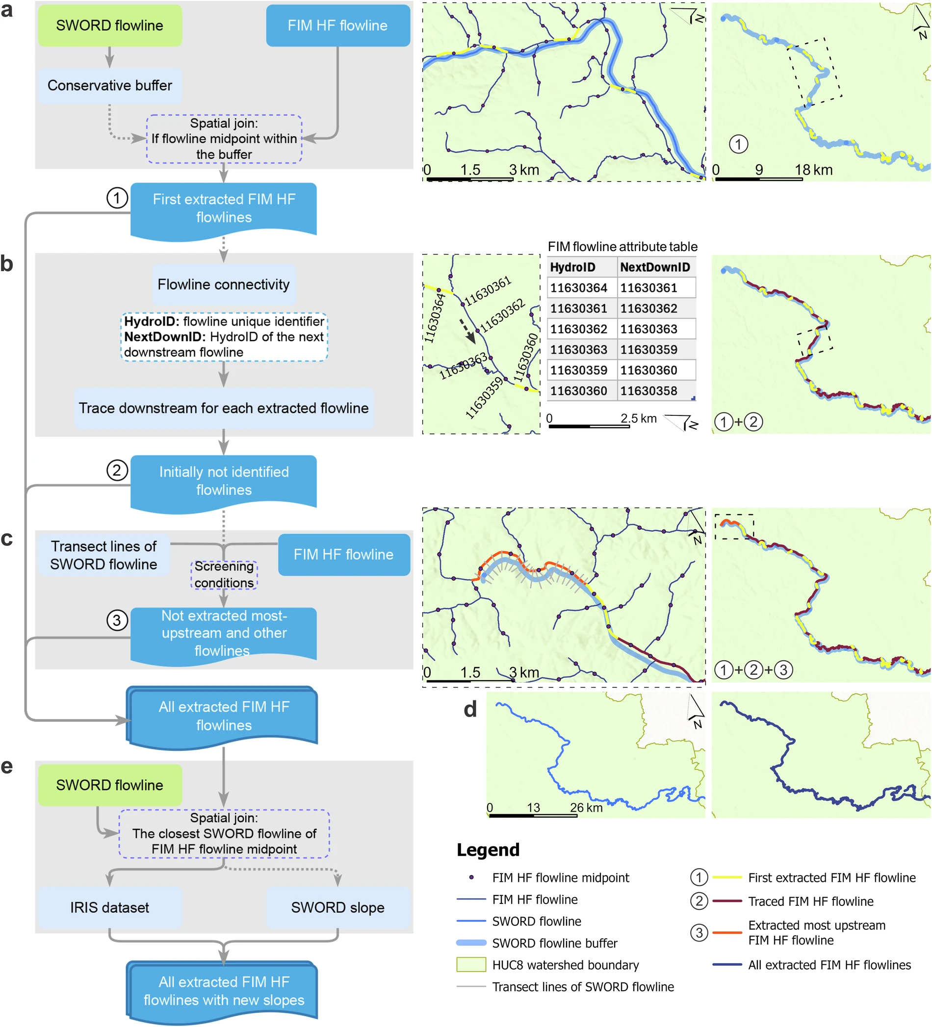
Water science workflows often depend on multiple hydrographic fabrics. RiverJoin helps connect them so data can move between systems with fewer manual steps. Its adoption by NOAA OWP reflects the value of a robust, reproducible approach to hydrofabric interoperability at the national scale.

Related Work