Dynamic Evacuation Framework
PostGIS and network-analysis project for scenario-based evacuation route planning.
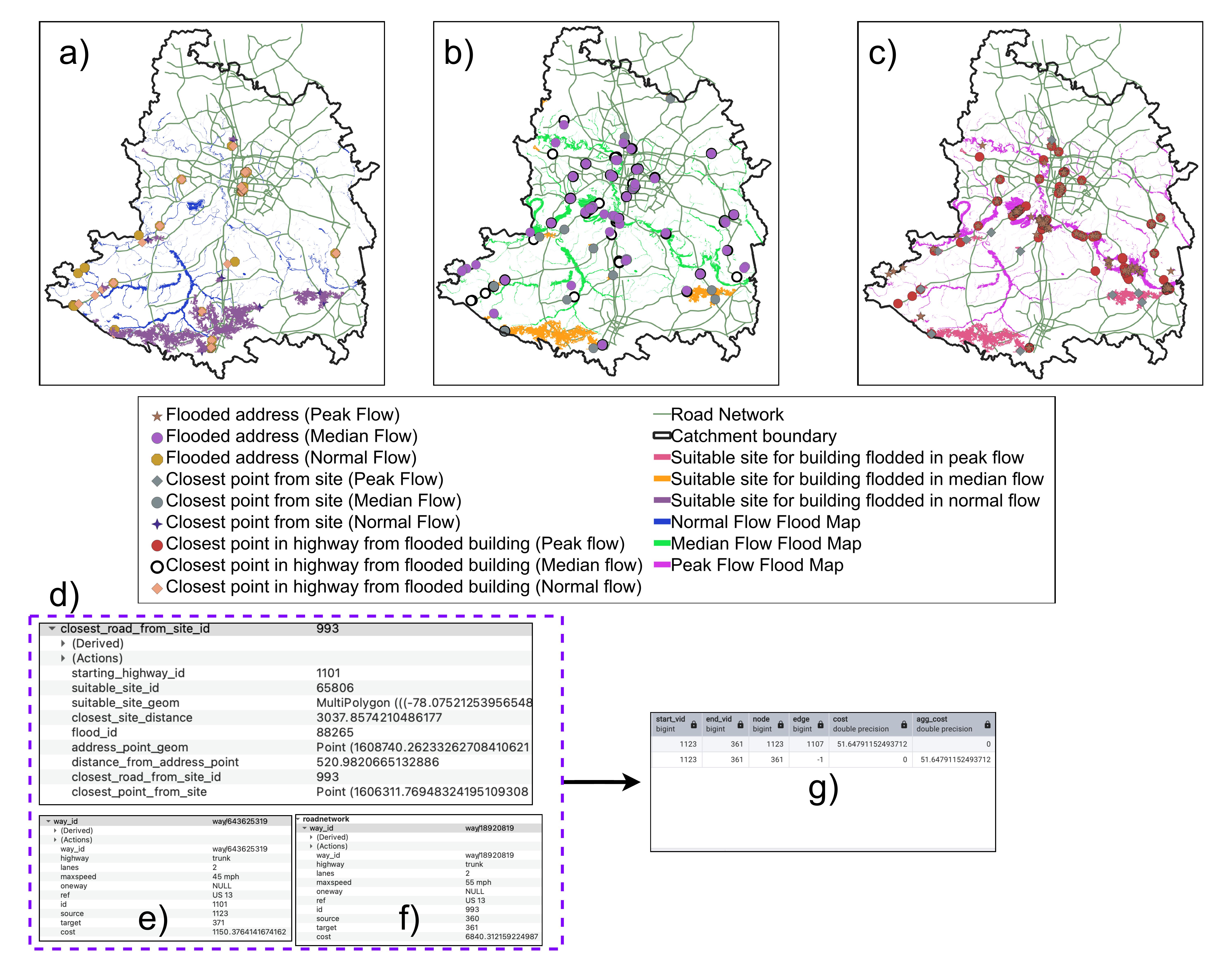
Read morePostGIS-driven evacuation routing, pluvial flood index design for NOAA's NextGen framework, deep learning weather forecasting, WebGIS risk communication dashboards, and field-to-database geospatial workflows — the full applied stack connecting spatial data to operational decisions.
Research outputs in water science only create value when they reach decision-makers — and that requires the full applied stack: reliable spatial databases, routing logic that updates as conditions change, interfaces that communicate uncertainty clearly, and field methods that produce trustworthy inputs. This theme spans that entire chain, from total station surveys in Nepal to PostGIS schemas for real-time routing to WebGIS dashboards for emergency planners. It shows that geospatial work is not just analysis — it is infrastructure for action.