GitHub
Source repository and examples.
Open GitHubExtract MS footprints based on AOI. msfootprint is a Python package for extracting Microsoft building footprints by user-defined geographic boundaries for urban mapping, exposure analysis, disaster assessment, and spatial data preparation workflows.
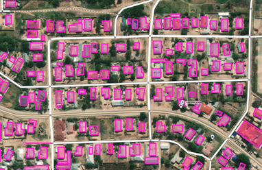
Building footprints are foundational for exposure analysis and many GIS services. msfootprint makes it easier to turn a global dataset into a local project layer. With over 15,000 downloads, it has become a widely used tool for researchers and practitioners working on flood exposure, disaster response, and urban spatial analysis.