GitHub
Source code and package repository.
Open GitHubFIMserv streamlines flood-inundation map generation using operational hydrologic forecasting inputs and HAND-based flood mapping workflows. It packages complex geospatial processing into a more reusable Python workflow.
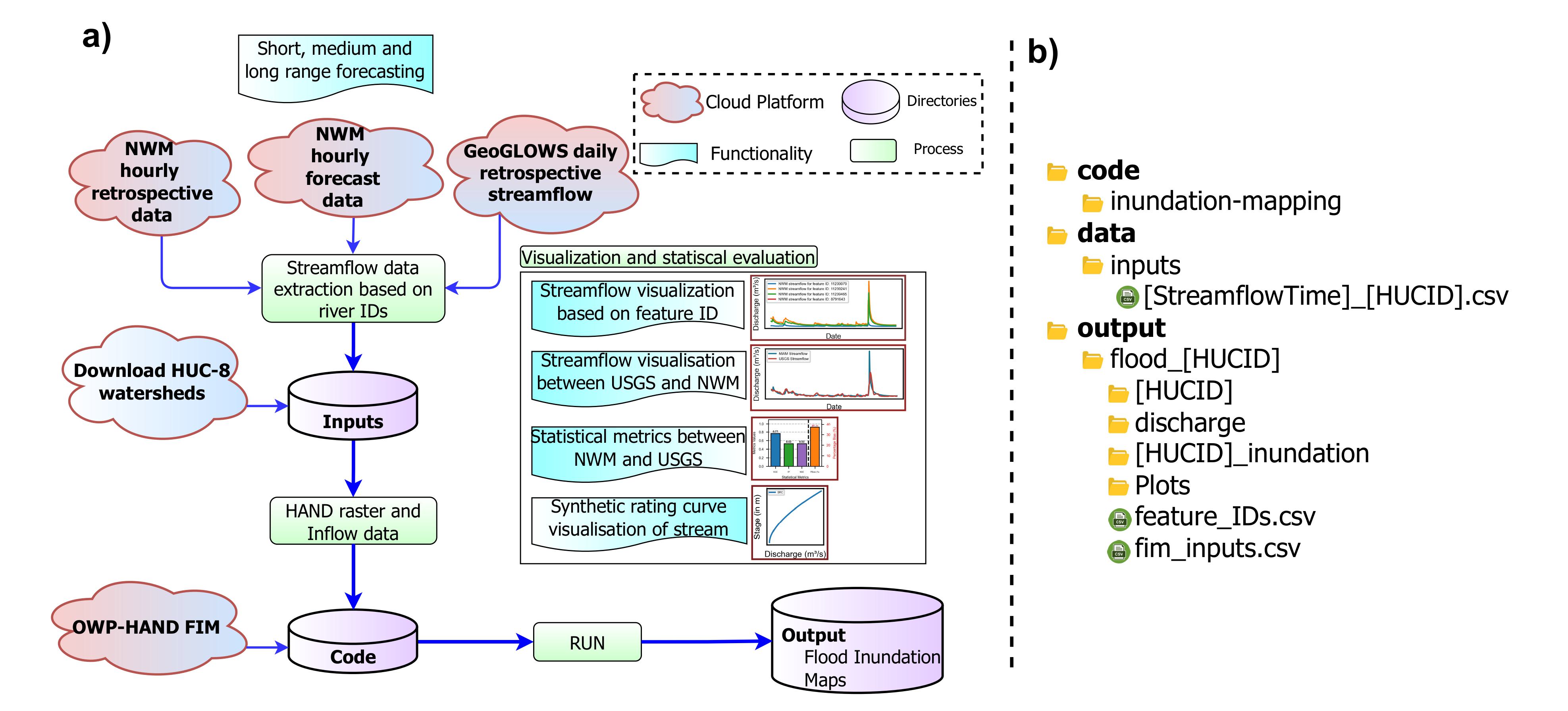
FIMserv reduces manual geospatial preprocessing and makes flood map generation more repeatable, easier to document, and easier to share with collaborators. With over 40,000 downloads, it has become a practical bridge between operational hydrologic forecasting and on-demand flood inundation mapping for both research and decision-support audiences.