Back to research
Remote Sensing · Hydrodata · Spatial Data Science

Remote Sensing Hydrodata

Research Brief Updated May 8, 2026

Satellite-derived river slope and water surface datasets — from ICESat-2 and SWOT — that improve the physical inputs to NOAA's operational HAND-FIM system, alongside hydrofabric harmonization, building footprint extraction, and large-scale raster processing pipelines.

SWOTICESat-2LandsatGDALGeoPandas
SWOT river slope and remote sensing data

What This Work Covers

  • ICESat-2 river slope dataset — high-accuracy water surface slope estimates derived from ICESat-2 ATL13 along-track products, adopted by NOAA OWP for operational HAND-FIM as an improvement over legacy NHD slope attributes in Manning's equation.
  • SWOT monthly slopes — global reach-level water surface slopes from SWOT River Vector products published on Zenodo; enables temporal analysis of river hydraulic dynamics at unprecedented spatial and temporal resolution across continental river networks.
  • RiverJoin — bidirectional spatial join between NHDPlus and MERIT Hydro river flowlines for hydrofabric interoperability; transfers ICESat-2 slope attributes across network products; methodology adopted by NOAA OWP for operational hydrofabric harmonization workflows.
  • msfootprint — Python package (15,000+ downloads) for extracting Microsoft Building Footprints for any area of interest from the global dataset; supports flood exposure mapping, urban risk assessment, and disaster impact analysis workflows.
  • Large-scale raster and vector processing pipelines using GDAL, Rasterio, GeoPandas, ArcPy, and cloud-compatible workflows for Landsat, DEM, and hydrographic data engineering at CONUS scale.

Why It Matters

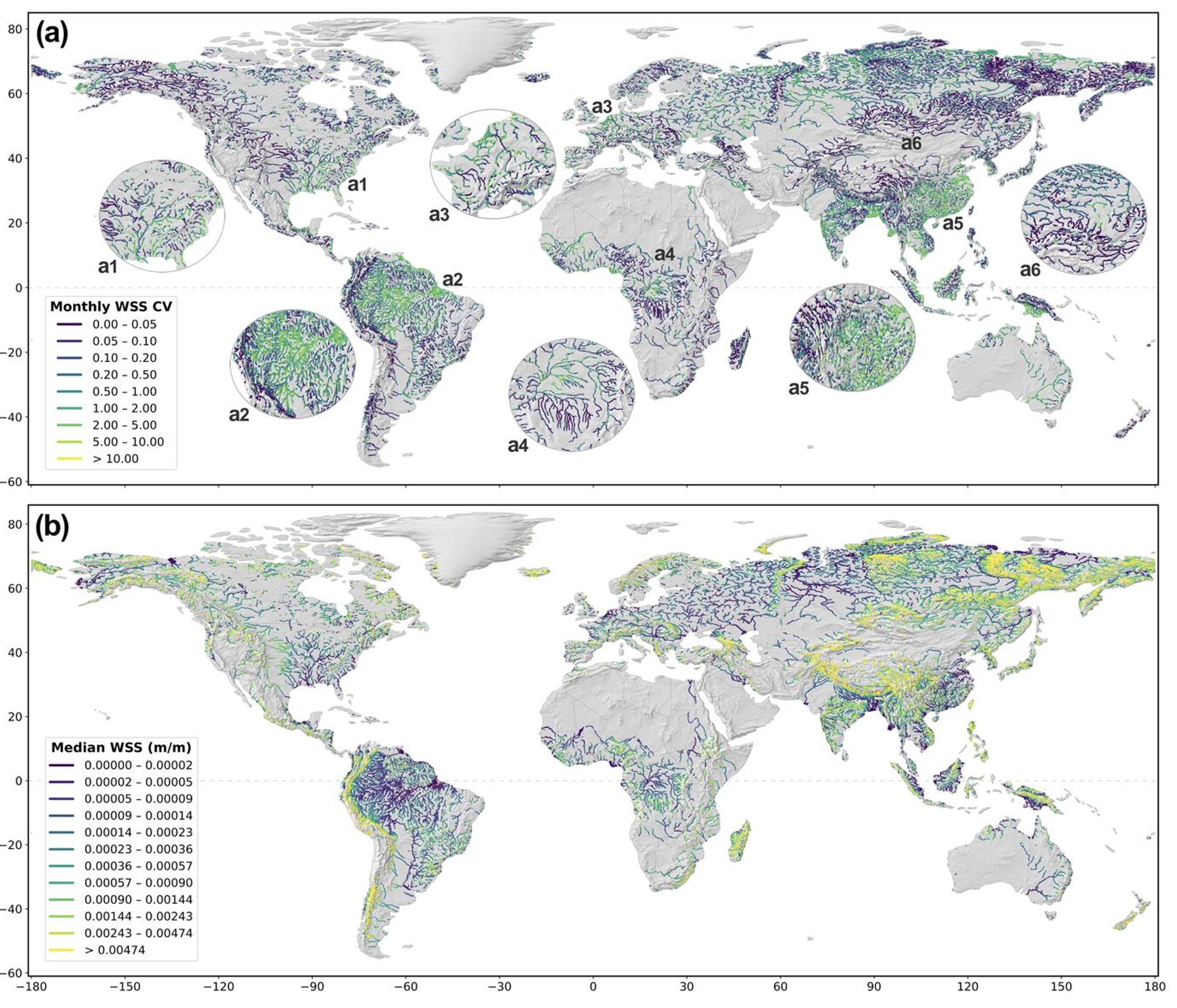
Flood inundation model accuracy is bounded by the quality of its physical inputs — and for HAND-FIM, river slope is one of the most sensitive parameters. Legacy NHD slope attributes carry significant errors from DEM noise; replacing them with ICESat-2 lidar-derived values directly improves every HAND-FIM prediction that uses them. SWOT extends this to global monthly time series, opening the door to dynamic model updating as river conditions change. These datasets are not supplementary outputs — they are the physical foundation that makes operational flood mapping more credible.

Related Outputs